

About
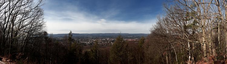
You can hike 235 miles of traprock ridges, steep river valleys, and dense forest from Long Island Sound up into the Massachusetts summits. It is a solid stretch of terrain for anyone looking to bypass the highways and walk through old farmland and quiet streams instead.
Updated
Charging at a glance
- Closest listed charger: 3.2 km (L2)
From the Open Charge Map listings under Charging nearby.
Quick Facts
Notable for: panoramic vistas and close-ups of New England’s natural and cultural landscape: traprock ridges, historic village centers, farmlands, unfragmented forests, quiet streams, steep river valleys and waterfalls
Founded: designated in 2009
Activities
- Hiking
Source: ctwoodlands.org
Charging nearby
Charging data from Open Charge Map
APPLEWOOD APPLEWOOD1
View on Open Charge MapL23.2 kmAMHERST OFF PK AOP SOUTH
View on Open Charge MapL25.6 kmAMHERST OFF PK AOP NORTH SIDE
View on Open Charge MapL25.6 kmCRC VILLAGE COMMON1
View on Open Charge MapL25.7 kmCRC VILLAGE COMMON2
View on Open Charge MapL25.7 km
Worth the detour?
No verdicts yet - be the first who's been there.
Sign in to leave a verdictAttribution
- ctwoodlands.org
- Connecticut Forest and Park Association
- NPS - National Park Service
- National Park Service - National Park Service, U.S. Department of the Interior
- New England Trail
- Recreation.gov (RIDB) - Recreation Information Database (RIDB)
- Wikidata - Wikidata / Wikimedia Commons
- Wikipedia - Wikipedia (CC BY-SA)