

About
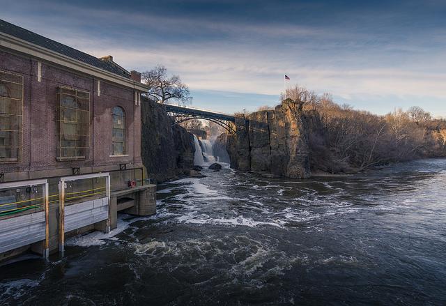
The massive drop of the Passaic River fueled the mills that built America's first planned industrial city. You can walk the paths where silk, locomotives, and aircraft engines once changed the country's manufacturing history.
Updated
Charging at a glance
- Closest listed charger: 0.7 km (L2)
From the Open Charge Map listings under Charging nearby.
Quick Facts
Notable for: America's first planned industrial city, centered around the Great Falls of the Passaic River
Camping and fees
- Entry fee
- : FreeSource: www.nps.gov
Seasons
- Snow closure (December to February)While the park is open every day, some park facilities and paths are closed during the winter.Source: www.nps.gov
Charging nearby
Charging data from Open Charge Map
Van Houten St. Garage
View on Open Charge MapL20.7 km1 Garret Mountain Plaza
View on Open Charge MapL21.5 km3 Garret Mountain Plaza
View on Open Charge MapL21.7 kmMANOR AT TOTOWA B
View on Open Charge MapL22.0 kmMANOR AT TOTOWA A
View on Open Charge MapL22.0 km
Worth the detour?
No verdicts yet - be the first who's been there.
Sign in to leave a verdictAttribution
- nps.gov
- nps.gov
- nps.gov
- NPS - National Park Service
- National Park Service - National Park Service, U.S. Department of the Interior
- Recreation.gov (RIDB) - Recreation Information Database (RIDB)
- Wikidata - Wikidata / Wikimedia Commons
- Wikipedia - Wikipedia (CC BY-SA)